
A grandmotherly woman in the ranger station traced routes on our maps with a red pen, writing in small dashed lines like the guides of a treasure map. The process took several minutes as she described with a lispy voice where she was taking us: to Bandelier National Monument then Farmington New Mexico for the night, before we would journey to Monument Valley. She was especially enthusiastic about Farmington, and when we left the station we carried stacks of maps and brochures for the area, which we still keep in our glove compartment because ya never know.


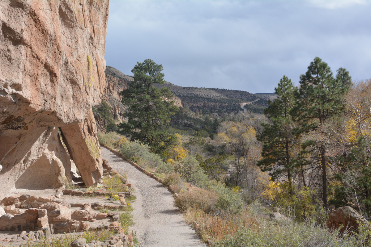
The drive into Bandelier is as beautiful as it is horrifying (for someone with a fear of heights). You corkscrew around the side of a mountain while losing 1000 feet of elevation, and though I want to remember the views forever, most of the time I was thinking “just let it be over.” Once arrived, I felt immediate relief until (1) we were informed that some of the trails were washed out from flooding, (2) there was a flash flood warning in effect and (3) we saw ridiculously ominous clouds in the distance.

This led to me pestering Carl about his survival skills for the first half of our hike.
“How long could you keep us alive if we were caught in a storm?”
“Mmmmm, about five days.”
“Can you build a fire?”
“I was an Eagle Scout of course I can build a fire.”
“What about food? Do you know how to forage?”
“I know which berries are edible. What are you going to do to help?”
“I have a granola bar in my purse, that’s what I’m bringing to the table.”

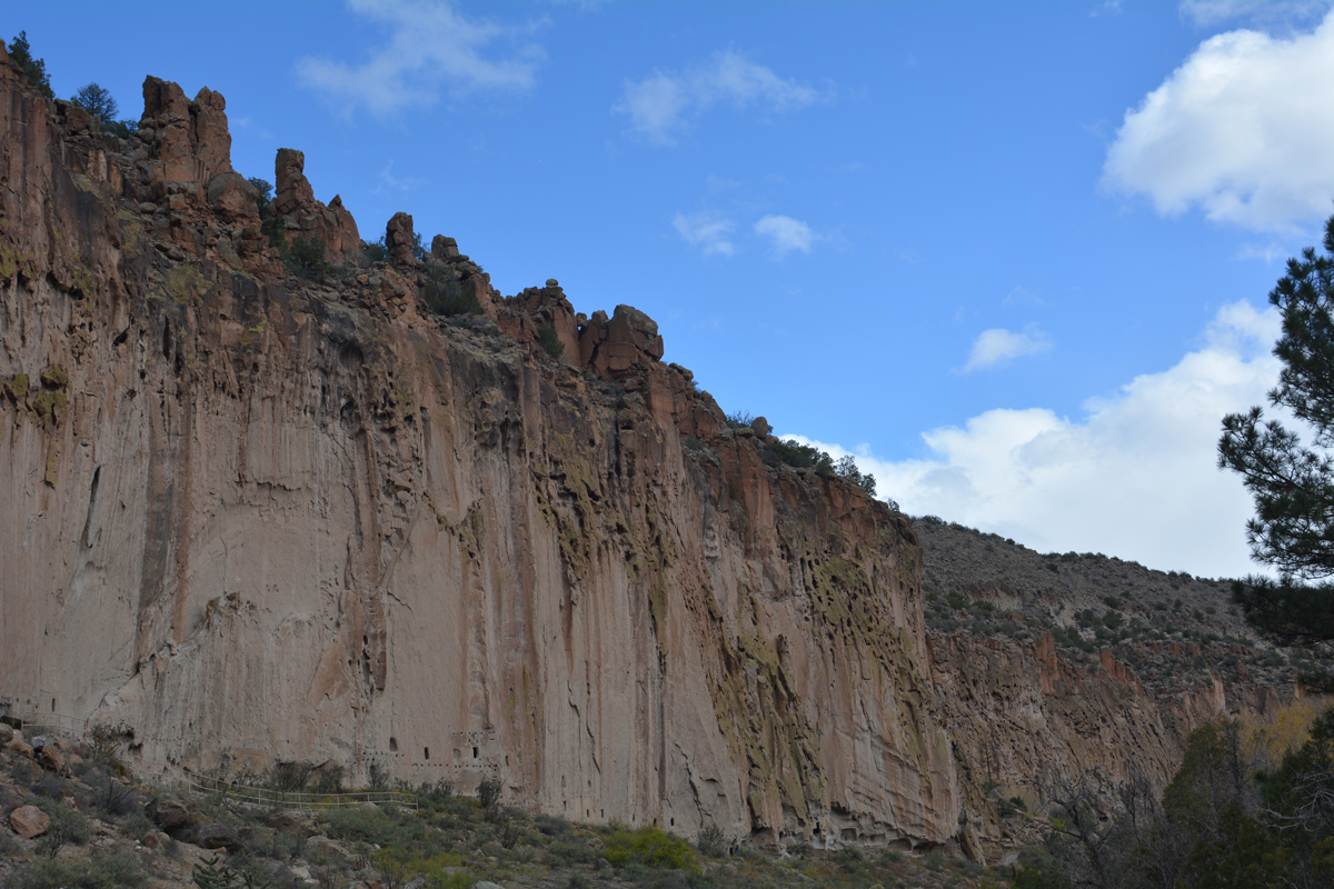
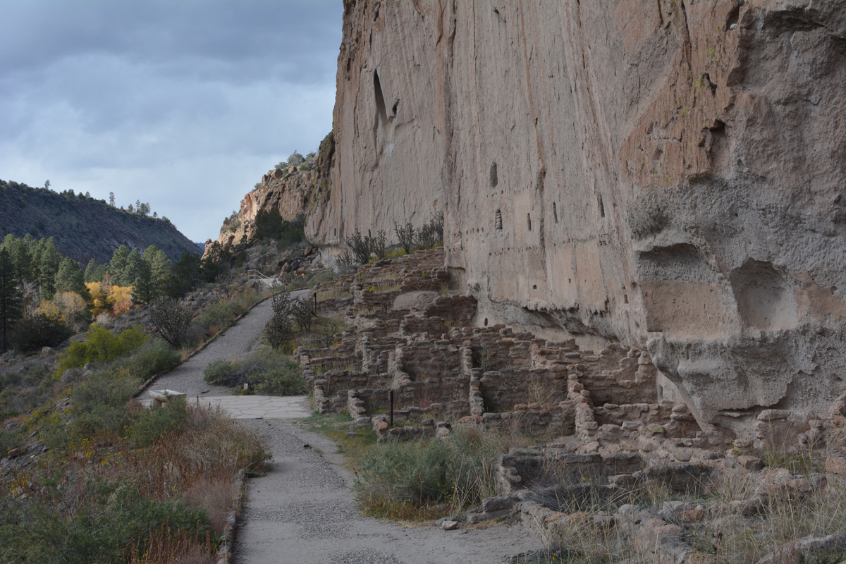
Bandelier monument preserves the dwellings of the Pueblo People who deserted the area 500 years ago, so I figured if we were caught in a wild downpour, at least shelter was provided for us. Small nooks were chiselled into the rock walls where a crouching person could curl up, but rarely could standing be accommodated. The ceilings are blackened from fires over the years, and the inner walls are textured and rough, with a carving here and there, a mid millennium means of decorating.

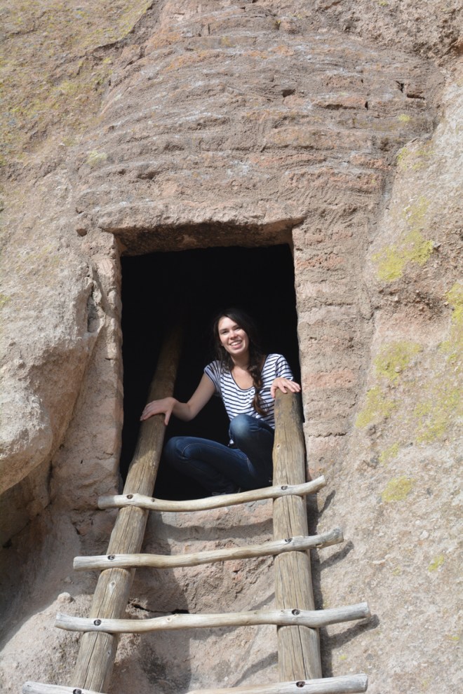
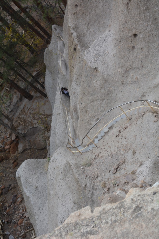
Access to these spaces is via wooden stairs nailed into the mountain, and even though I know the ladders are secure, I still don’t really know the ladders are secure (fear of heights and imminent death storm on the mind). In the end I persevered and climbed up every damn ladder around, even up to Alcove House, which the National Parks site describes as consisting of “4 wooden ladders and many stone stairs.” Worth it though because the view of surrounding Frijoles Canyon during late fall is on fire with burnt oranges and golden yellows. After the descent and walk back, it was apparent that the storm had passed, which was indeed what I wanted, but I was a bit disappointed I didn’t spend more time in Alcove House and explore the underground Kiva (a room used for religious rituals and spiritual ceremonies).


Back on the road we didn’t have the same weather luck though. We drove into a blizzard. In October. In New Mexico. (Miss the rainstorm and you’ll wind up with snow.) This situation would’ve seemed impossible to me prior to our trip, but I’d learned one often forgotten point of the area: the elevation will sneak up on you. Soon we were driving in darkness, watching snowflakes streak the windshield. Then I noticed flames burning off the highway. Not a fire, just single flames appearing intermittently in the distance.
For a while I thought we were driving through a Cormac McCarthy novel, but I’ve since found out that we were witnessing flaring. A process oil companies use to burn the natural gas found when drilling for oil. Since oil is more valuable than gas, and the transportation of gas is expensive, the gas is just burnt off. It’s a waste of resources (the amount gasoline burnt each day could easily heat all of Seattle’s 300,000 households for a day), it’s bad for the environment (over a million tons of carbon dioxide is released each year from flaring), and it’s eerie as shit when you have no clue what’s causing the 40 foot tall columns of flames.

Since all the photos I took of this from the car came out terrible (obviously), I’ll use an image from Daniel Acker at Bloomberg.com to show what flaring looks like. Now just imagine the flames in a dark, blizzardy desert.
All we could see was the snow in front of us lit with headlights, blackness everywhere else, and flames speckling the landscape. It was one of those days where at no point you think you’ll actually get to your destination.
But around midnight we pulled into the hotel parking lot in Farmington, while signs announced a club connected to the hotel. For your partying and sleeping needs! Drunk driving is a huge problem in the region, since the closest bar tends to be miles and miles away from home, while cabs and public transit are nonexistent. Having the walls of my room thwomping with bass all night was not an appealing prospect, but either it was a slow drinking night or I was too exhausted to notice the room pulsing, because I slept until woken by our 7:00am alarm. At which point I rolled out of bed, had another continental breakfast of frosted flakes and black black coffee, then got back into the trusty passenger side seat for another day on the road.
