The alleyways of Europe have infinite charm; Japan’s Shibuya Crossing is a testament to the metropolises that man can build, but the American Southwest — there is not a place like it in the world.
Step into a Southwestern desert and you’ll understand why Georgia O’Keeffe paintings are so barren yet so beautiful. There’s a whole lot of nothing in most of Utah, New Mexico and Arizona, but you should see the way light hits that nothing. I never knew there were so many shades of orange, or understood how many patterns the wind could carve into a single stone.
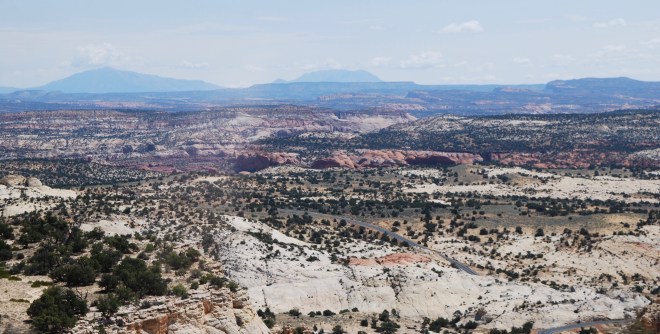
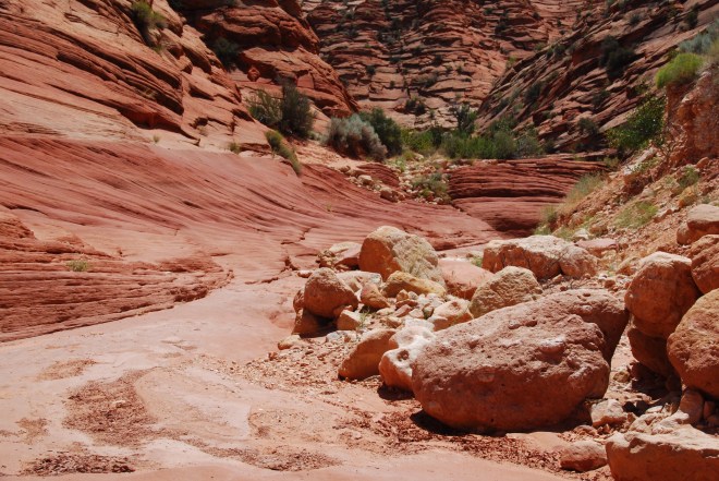
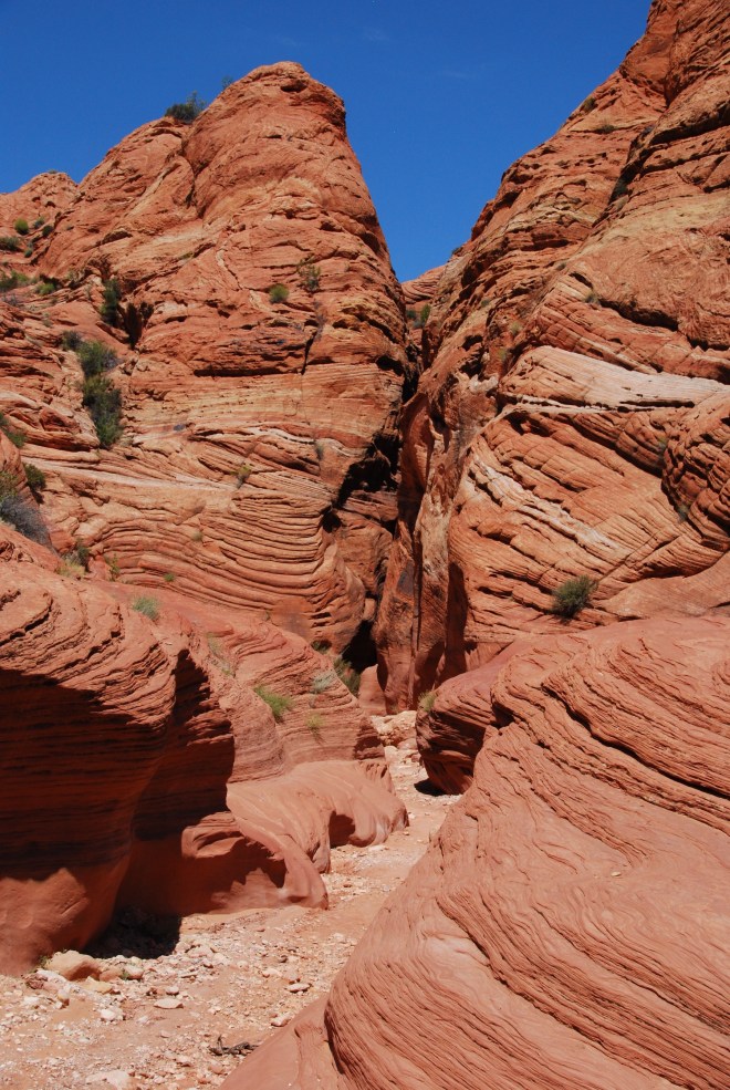
Open spaces in this region are vastly overwhelming in their scale and beauty, but slot canyons, some of the narrowest spots you’ll wedge yourself into willingly, will drop your jaw just as much. Slot canyons are a rarity in the world; narrow canyons formed as water rushes through rocks, they’re located almost exclusively in Australia and the Southwestern United States, with over 1,000 in Southern Utah alone.

Growing up I had a photo of Antelope Canyon (ripped from a National Geographic calendar) pinned to the bulletin board in my elementary school bedroom. Dream destinations of those years were Africa, San Francisco and the open deserts and narrow canyons of New Mexico and Utah. Looking back I suppose I had a thing for golden landscapes — there was a color palette to my grade school bucket list — and visions of amber and apricot swirled in my head for decades to come.
Hitting the road for a one-month West coast to East coast road trip, there were few places I had booked ahead of time: The Lodge in Glacier National Park, a B&B in Colorado the night before the eclipse (Wyoming was booked up months in advance), and a tour of Lower Antelope Canyon. During our move West four years earlier we were within miles of the canyon, but had to drive right on by since tours sell out, even though there are dozens every day. I’m not complaining, as we were able to make an impromptu drive to the Grand Canyon in its place, but I was not missing Antelope a second time around.
Whilst planning for our trip we had missed one rather important detail though: August is flash flood season. If there’s any sign of a dark sky above or lightening ahead, in no way should you venture into a slot canyon, as they can be less than three feet wide and miles long. When monsoons hit, they flow through the canyons at rapid speeds, taking down anything and anyone in their path. We’d fled trails in Bryce Canyon due to sudden storms, and we’d gone to sleep in Capitol Reef National Park with the sounds of rain pounding on our tent.
Each day we’d spent in Southern Utah the sky opened up at 3:00pm to drench the deserts, before suddenly retreating, leaving the earth to dry out again, and within hours the land would be parched once more. Due to this pattern, we weren’t taking our chances with just one slot canyon, we were playing the odds (playing the slottery, if you will), and added a second slot to our itinerary in case of rain during our Antelope day. First up was Zebra Canyon in Grand Escalante National Monument.
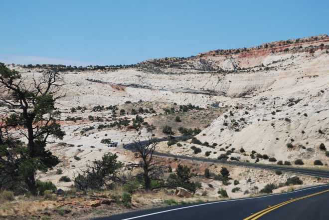
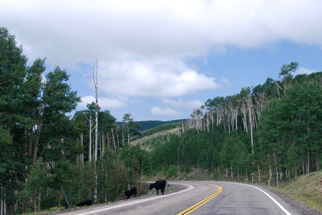
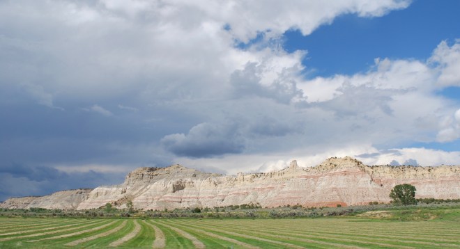
The drive to the canyon was incredible. I say a lot of drives are incredible, as I go on a fair amount of road trips and frequently take the scenic route, but this one was a standout. Coming from Capitol Reef National Park and heading towards Bryce Canyon, we took Route 12 passing directly through the densely wooded Dixie National Forest where we drove next to cows on the road, and on into Grand Staircase Escalante, where it’s all expansive vistas and dried earth.
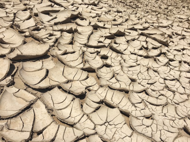
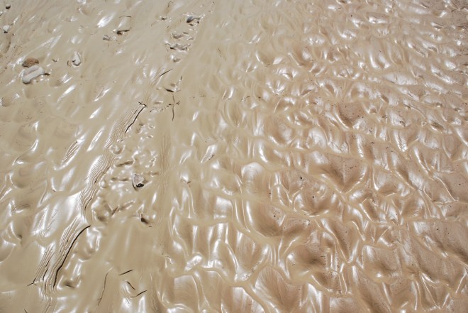
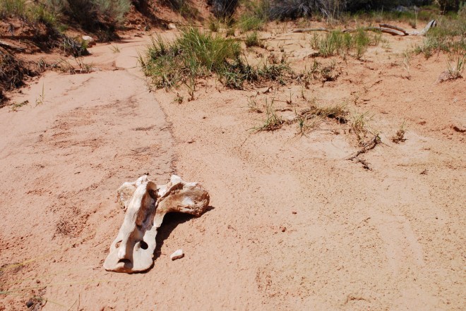
From the main drag it’s a 20 minute drive to the trailhead. Less than eight miles, but it’s the kind of road only four-wheel drive vehicles should attempt, and I watched our Highlander kick up dust and gravel along the way. Nothing but blue sky overhead, we hit the trail shortly after noon. The first mile on the trail is easy, you’re just walking through brush on a teensy tiny dirt path. Quickly though, the path ends and you’re left following a gulch to the canyon, a gulch formed by flash flooding. Half of the trail was damp and glistening with yesterday’s waters which had yet to burn off, while the other half of the trail was bone dry, parched earth breaking apart into shards. There were bones in the gulch too… large bones.
All this was made all the more disconcerting when with less than a ½ mile to the slot canyon entrance, I saw lightning flash in the distance. When lightning is seen you do not enter a canyon roughly the width of a small coat closet. You do not pass go. You do not collect $200.00. You get the hell out of there. To quote the Utah visitors site on the slot canyons of Grand Escalante: “In these canyons, as little as .25 inch of rain can run off the slickrock landscape and turn the slots into inescapable death traps.” Being an anxious person already, you had me at “inescapable death traps”.
We started back at a brisk pace, through the gulch whose breadth made me gulp; we passed areas with a width of fifteen feet, meaning when the sky opens, it takes everything with it. Looking over my shoulder and seeing the sky turn dark, the brisk pace turned into a light jog, especially after passing what appeared to be the pelvis of a cow or ox. Normally I wouldn’t recommend jogging in the desert; you’re already dehydrated and if you injure yourself there’s no one there to find you. However, this was not a normal circumstance and we made it off the trail in record time.

The town of Escalante was a short drive away and the rains had yet to fall, but entering the Grand Escalante Visitor Center my phone found reception for the first time in hours and started screaming hysterically about a flash flood warning in effect. Hearing this, we did the reasonable thing and drove to nearby Bryce Canyon, set up a tent, and wound up camping in what turned out to be an off and on storm lasting the 48 hours we spent at the park.
Waking up cold and early in Bryce, we hit the road, heading back into Grand Escalante, eyes set on one of the most recognizable hikes in the world: The Wave. Doesn’t ring a bell? Google it. Seriously, you’d think an image search of “the wave” would churn out sports fans standing in unison in a stadium, or the iconic Japanese painting by Katsushika Hokusai of a wave tall and menacing ready to hit the sea. But lo, no sports fans pop up, and Hokusai doesn’t hit until the twelfth image of so. You’re met with hundreds of photos from Utah’s wave. In fact, just searching for “wave” will produce this hike lickety-split. In today’s world, if Google says it is so, it is so. If Google says we should take notice of something, we always do.
We were beyond excited. We couldn’t wait to arrive at this orange oasis. We never made it.
Leading up to our road trip we’d had a busy few months. Carl and I bought our first home (yay!) in a city we weren’t currently living in. There was packing to be done, timing logistics, a basic road trip itinerary that needed worked out… in short, some balls were dropped. And one of those balls was actually reading about hiking the wave, rather than just having it recommended to us by the internet based on our general expected travel radius. Read an article on the wave and it’ll tell you flat out: you need a permit to hike this trail.
Big deal, right? You just stop off at the visitor center and grab a permit. Nope. Only 20 people are granted permits to hike the trail each day, all drawn from a lottery. 10 of those permits are doled out online months in advance (odds of winning are as low as 4% during the peak season), and 10 are drawn in person every day at the Grand Staircase-Escalante National Monument Visitor Center in Kanab for the day before you want to hike. If you want to hike tomorrow, you need to wake up bright and early and hit the center that day. We missed the drawing by 20 minutes. Womp womp wooooomp.
I was bummed for 15 minutes, sure, but we were on an adventure dammit. If everything goes to plan what fun is that? We waited to ask some questions while the ranger was tied up on the phone, trying her best to patiently explain that permits were won in a lottery and not purchased.
“No, it’s not a ticket, it’s a permit.”
“If you win, it’s $5.00 for the permit, but there’s no “cost” to hike, no. It’s not something you buy.”
“Well, you come in person to our station and you put your name in a drawing.”
“I cannot accept payment for a higher denomination, and allot a permit to you over the phone sir, you have to come in person and win in a lottery with others.”
“No. It is not “sooold out” as there are no “tiiick-ets.”
A wee bit exasperated, the ranger was relieved when we weren’t coming to berate her for not winning, but rather to ask for an alternative hike in the area. The South Coyote Buttes were preferable, as that’s the general area of the Wave.
She confirmed that we did in fact have a four-wheel vehicle, then noted a few recommended substitutes on a map. I absolutely adore the way rangers highlight spots on a map — some X out the destination, some make perfect circles, others use markers to create a color-coded guide. Everyone’s style is so different, but I truly feel like each person means it, as they all make their marks with such fervor. Our new destination? Wirepass Gulch. A slot canyon. Game on.
We drove down a dusty out of the way dirt road; again. Walked along a gulch; again. But here’s the kicker, we actually made it to the slot canyon. Our blue sky stayed blue. Almost unnaturally blue. Few clouds hung above, and any that did linger were perfectly white and puffy, and dotted in a sky of pure cerulean.


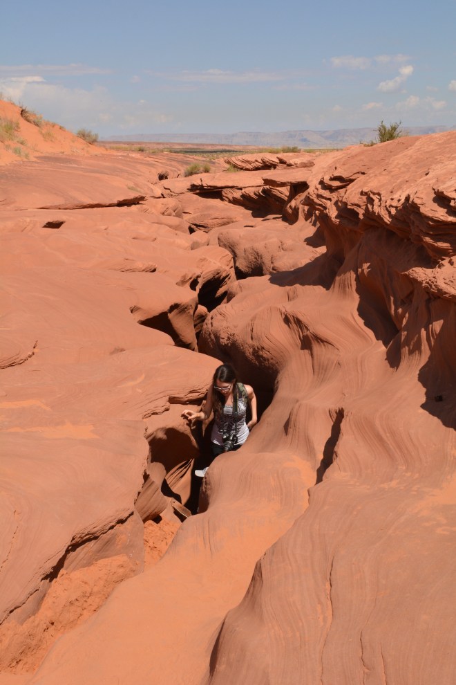
Though the hike is described as “easy” online, a rockslide has blocked off the canyon’s entrance, so some moderate rock scrambling is involved to dip into the canyon further down. Otherwise the trail is super accessible, and it’s almost exclusively yours. During our trek we passed a thirty-something solo American man and a group of Germans, but otherwise we were completely alone along the route. If you’re looking for solitude, you’ve found it. And if you’re looking for natural beauty, you’ve got that as well. I’d describe the hike as walking on Mars (my only glimpses of Mars come from glossy magazines, but still). You’re alone on a red planet, whose terrain couldn’t give a damn about you. It’s like a space race, and you and some German dude won.

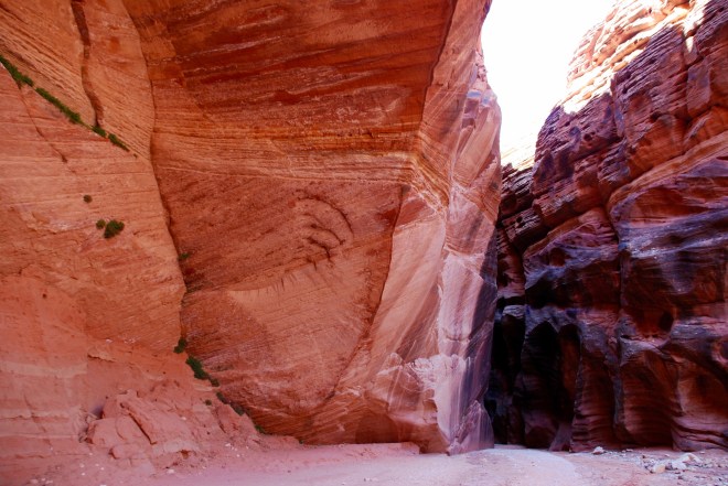
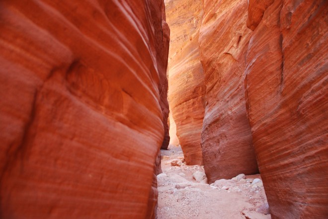

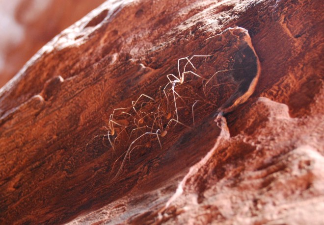
Claustrophobic individuals are not welcome here. The canyon is seldom wider than a few feet; the walls are craggly rocks, wet in some places, and covered in spiders or lizards at others. After a bit of journeying through the canyon you’re spit out into an open rock valley where you can breathe freely for a few minutes, before turning back around for some close quarters rambling back to the trailhead.
Post-hike we drove out of the way to Big Al’s burgers in Kanab. If you find yourself in Southern Utah and you don’t make a stop here, you’ll regret it without ever having known it. We dined like kings on buffalo burgers, onion rings topped with fry sauce (the perfect ketchup/mayo ratio), and malted milkshakes. After sweating out all your body’s salt in the desert, replenishing it with drive-through sodium feels incredibly indulgent.
That evening we camped on Lake Powell, a short drive from the big show in town: Antelope Canyon. An interesting point on travelling through Southern Utah, we ran into more French tourists than we did U.S. ones. At Bryce Canyon I was overwhelmed by the amount of stylish families whose teenage children could not be less wowed by the park’s beauty, and while lounging on the beach at Lake Powell we were surrounded almost exclusively by sexy French couples vacationing with who would inevitably become their first husbands/first wives.
At 8:00am the next morning cars raced passed us on the otherwise empty highway. I couldn’t say if this is a regular occurrence, but I blame it on Arizona’s weird daylight savings rules. Only certain parts of Arizona observe daylight savings time, meaning that on Lake Powell it could be 8:00am, but a stone’s throw away at Antelope Canyon in Page, it could be 9:00am. Being only a 20 minute drive between the two spots, and in the same state, this can get pretty confusing. So I would imagine Arizona is the kind of place where people don’t cross a particular line in the sand: Like New Yorker’s who don’t go North of 60th, or like when I lived in Philadelphia and had an aversion to crossing Broadway on foot.
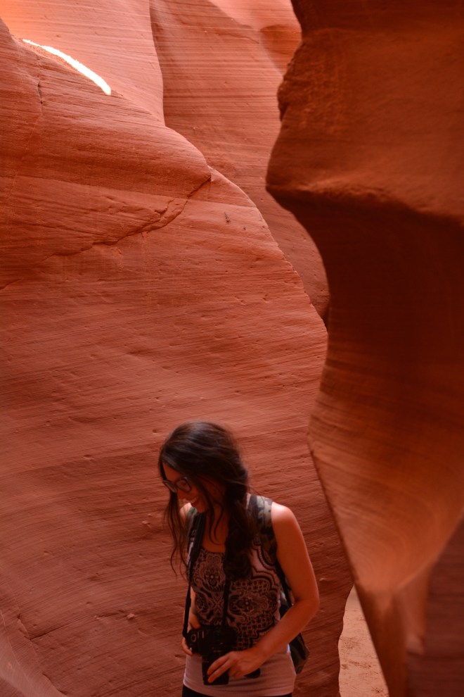
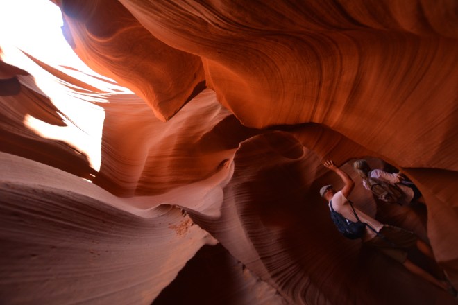
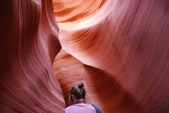
I was not toying around though. I had familiarized myself with Arizona’s time zone shenanigans, and anticipated this, setting my alarm to accommodate the change. We’d booked a tour at Lower Antelope Canyon, as I’d read it was less crowded than the Upper Canyon, where the famous light beams are more likely to occur. Driving into the tour headquarters for Lower Canyon though, I cannot imagine a more crowded spot.
We booked with Dixie Ellis’ tours, and they shared a lot with a half dozen or so other tour companies. Each company had a small wooden stand in the desert checking people in, with a 100-person crowd swirling around it. Since a couple hadn’t shown up for their 8:20am tour slot we were able to shimmey into their place. “Huzzah!” we exclaimed to ourselves, and started towards the canyon only to wait in line with all other tour groups, eventually making it in just shy of 10:00.

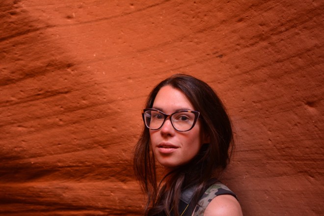
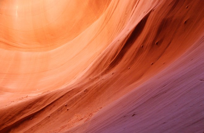

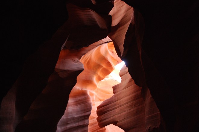
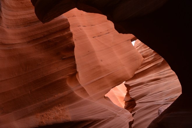
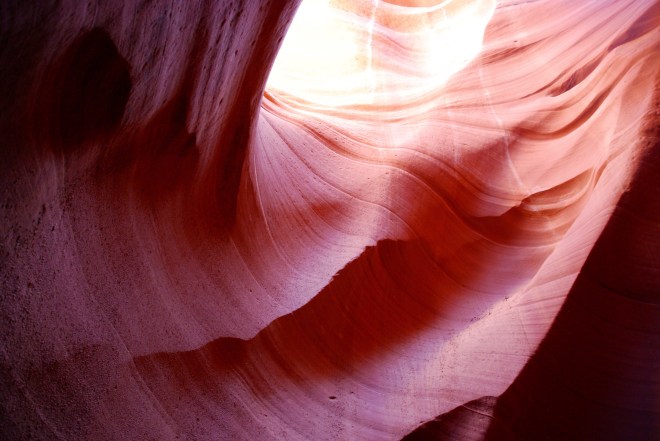
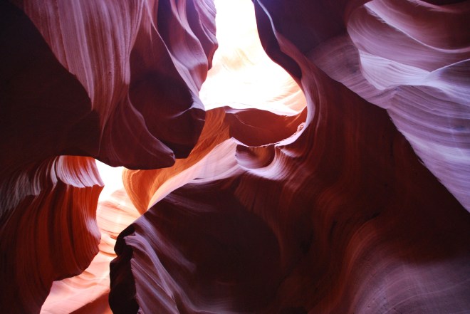
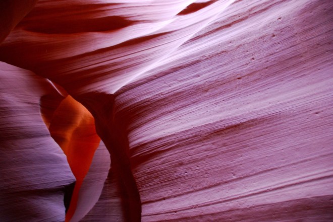
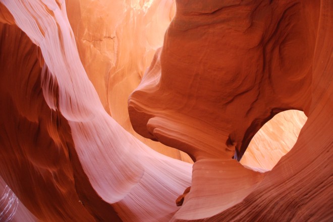
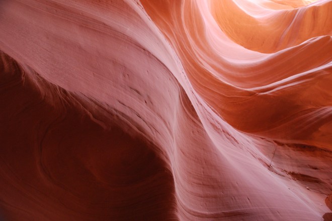
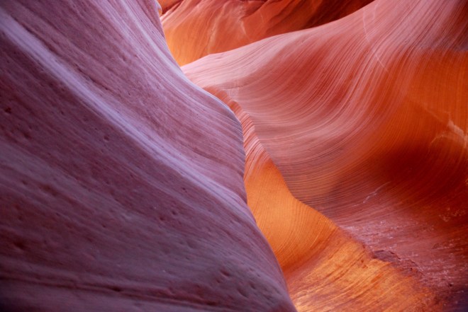
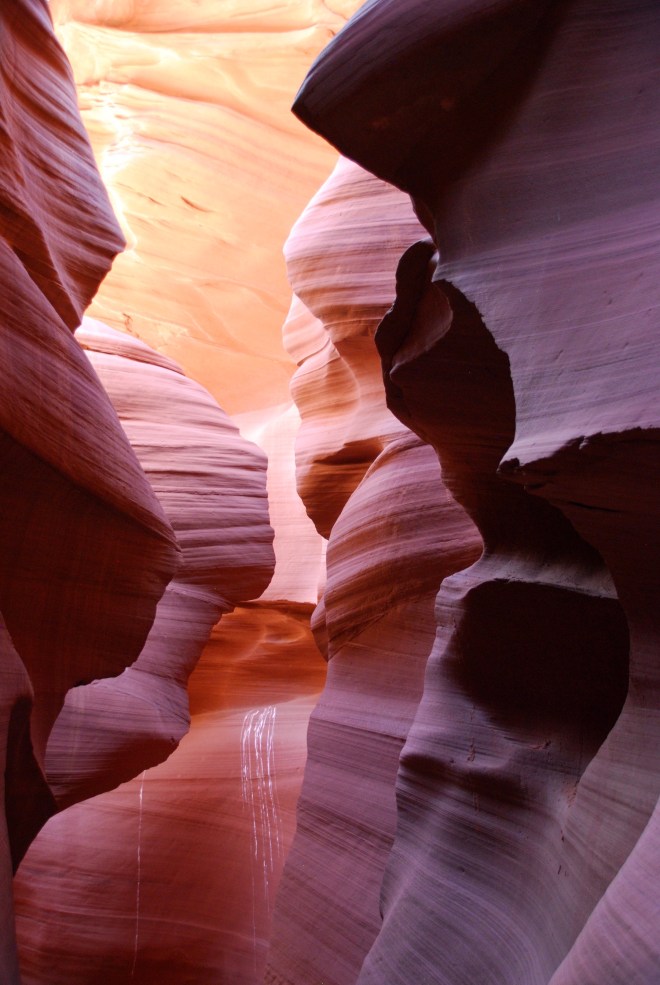
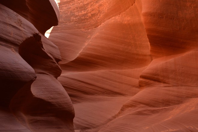
Me-oh-my. A single rock wall can range from rich violet to canary yellow, with thirty different colors in between. It’s a play between light and shape. The deeper you go the more everything is lit in aubergine, and as you’re reaching the surface again you think you’ve struck gold the way patterns on rocks glisten. You don’t need to be a professional photographer to come away with gorgeous photos. The space comes alive for everyone in it, twisting into shapes that are different for each individual. Look one way and you may see a delicately curved wall, gently waving skyward, but look in a different direction and the angles could be sharp, a black wall spiraling into bronze.
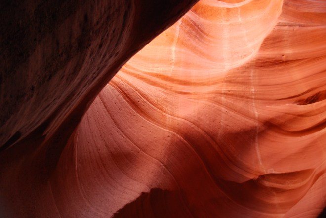
Carl and I each had our own camera, and due to our varying device settings, what’s fuscia to me in a photo could be a deep umber for him. Two people cannot experience the same Antelope Canyon. There’s something deeply comforting about this to me; so many places you go are a shared experience. If I look off the top of the Empire State building that’s the same view thousands of others have witnessed. Sure, others have seen it at night or at sunset, but still the buildings form the same pattern for everyone. The Chrysler building doesn’t transport itself to a new block for each visitor.
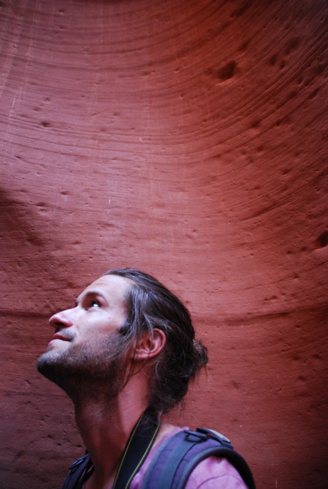
Climbing out of the canyon and back into the sun, I was already aware that though Carl and I had stood next to one another, our perceptions of the canyons were our own, and couldn’t be adequately communicated to one another. Like a secret we were both in on, or a song we hum just a bit differently.

The Southwest may be mostly burning earth and blue sky, but it’s the way the landscape can present itself to you that can produce such a personal response. The emptiness makes you search for something, anything — causes you to squint at what’s in front of you, and it’s then that things begin to transform and take shape into something entirely your own.

One Comment